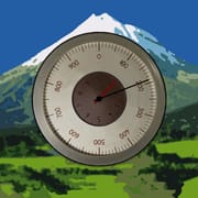
Accurate Altimeter delivers precise elevation tracking using advanced GPS and barometric sensors. Ideal for hikers, climbers, and pilots. Get real-time altitude data worldwide.
This Android altimeter application has achieved significant popularity and sets itself apart through its reliable performance in remote locations where network access is unavailable. The application employs three complementary approaches to determine elevation, guaranteeing consistent results regardless of connectivity status. The first approach utilizes satellite-based positioning to establish altitude coordinates. While this technique delivers baseline elevation data even when offline, it operates with reduced speed and somewhat lower precision compared to alternative methods. The second approach incorporates global terrain databases to identify ground elevation at the user's present coordinates. This technique improves measurement accuracy by comparing the user's position against established elevation records. The third approach, when the device possesses the necessary hardware, analyzes barometric pressure readings to calculate altitude. Calibration using atmospheric data from local meteorological stations enhances this method's reliability considerably, enabling dynamic corrections and improved precision. The application emphasizes intuitive design and straightforward information presentation. A historical tracking feature displays elevation changes over time, offering users a visual timeline of ascents and descents. This proves particularly valuable for hikers, climbers, and individuals monitoring their vertical progression. The mapping system incorporates labeled peaks and elevation contour lines, facilitating terrain recognition and geographical awareness. Users can obtain elevation readings from any location on the map, supporting route planning and pre-assessment of specific waypoints. An additional capability allows geographical labels and elevation data to be embedded within photographs, creating attractive and informative documentation of outdoor excursions. This combines practical functionality with visual appeal, enabling users to share their adventures compellingly. The application's offline operation and multi-method altitude determination make it indispensable for adventurers exploring regions with restricted or absent network coverage. The combination of historical tracking, detailed mapping, and photographic features significantly increases its practical value. The development team has clearly prioritized reliability, precision, and comprehensiveness, catering effectively to both recreational trail users and experienced climbers.
The premium edition of the application provides users with expanded capabilities that significantly improve its performance and precision. A particularly important enhancement involves calibrating pressure sensor inaccuracies, which can substantially increase the trustworthiness of altitude measurements. While pressure sensors typically deliver acceptable results, they remain susceptible to environmental conditions such as temperature fluctuations and calibration drift. The premium version tackles these challenges through sophisticated algorithms designed to offset such discrepancies, thereby guaranteeing more accurate elevation calculations. Another notable improvement in the premium edition concerns the capability to retrieve expanded areas from worldwide topographic datasets. This functionality proves especially advantageous for individuals planning extensive journeys or venturing into locations where comprehensive cartographic information may be inaccessible. By obtaining broader map segments, users can maintain access to detailed elevation data even without active internet connectivity, facilitating more effective journey preparation and wayfinding. The premium version also enables altitude logging to continue functioning while the application resides in the background. This capability serves perfectly for monitoring elevation variations throughout prolonged activities like multi-day trekking expeditions or extended automobile journeys. The accumulated data can subsequently be examined to extract meaningful information regarding elevation patterns and overall vertical progression. The liberty to identify elevation values at any location on the map without imposed limitations represents an additional valuable characteristic of the premium offering. The complimentary edition may restrict how many elevation identifications users can perform within specific timeframes. The premium variant eliminates these constraints, enabling unrestricted exploration of the cartographic interface and retrieval of elevation data for any point of interest. Furthermore, the premium version completely removes promotional content, delivering an uninterrupted and seamless experience. This advantage proves particularly meaningful for regular users who prefer to avoid visual interruptions. Together, these enhancements render the premium edition a compelling investment for dedicated users who require superior precision, comprehensive functionality, and enhanced usability. The integration of pressure sensor calibration, expanded offline mapping capabilities, persistent background logging, unlimited map-based elevation queries, and an advertisement-free interface substantially increases the application's practical value, establishing it as an essential companion for outdoor exploration and adventure activities.
This Android altitude measurement application delivers dependable performance for tracking elevation changes without requiring an active internet connection. The application employs three distinct technical approaches to determine altitude: GPS-based satellite positioning, comprehensive global terrain databases, and the device's built-in barometric pressure sensor. This diversified methodology guarantees consistent accuracy across varying connectivity scenarios and environmental situations. The interface provides intuitive functionality through several notable capabilities. Users can review historical elevation data displayed in chart format, explore detailed cartographic overlays featuring peak identifiers and topographic contours, and embed elevation metadata directly onto captured photographs. These elements significantly enhance user engagement and practical utility for individuals who spend time in mountainous environments. The premium version expands functionality through several refinements. Calibration algorithms correct pressure sensor deviations, expanded geographic regions become available for offline map storage, continuous elevation tracking operates in the background, geographic boundaries on map selections are removed, and advertising content is eliminated. These improvements address the requirements of demanding users who prioritize precision, comprehensive features, and seamless operation. The application serves as an exhaustive solution for elevation tracking, establishing itself as a valuable resource for trail walkers, rock climbers, and any individual monitoring vertical movement. The development team has crafted an accessible yet sophisticated application appealing to diverse user segments ranging from recreational outdoor participants to experienced alpinists. Its capacity to operate independently of network infrastructure while delivering accurate measurements through multiple technological approaches distinguishes it within the Android altimeter marketplace. The incorporation of historical records, cartographic visualization, and photographic integration amplifies its practical value. Emphasis on consistency, precision, and superior user experience positions this application as a leading option for those seeking trustworthy elevation data on their Android smartphones. The convergence of offline capability, varied measurement techniques, and premium enhancements differentiates this product from alternatives while rendering it essential for wilderness excursions and other elevation-dependent pursuits.


 4.40
4.40
 APK
APK